Stafford Hamlet Community
As residents of a rural unincorporated area in Clackamas County, we have adopted a set of Values and Vision for our community. The Stafford Hamlet was born out of the idea that change is inevitable, including changing the way we develop. We value the qualities – the "Stafford Character" – that make our community a desirable place to live.
What's Happening in The Stafford Hamlet

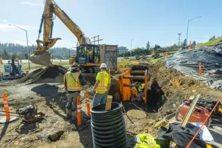
Stafford Road (Pattulo Way to Rosemont Road) Improvements
Stafford Road (Pattulo Way to Rosemont Road) Improvements ...more
New
April 12, 2025•3 min read

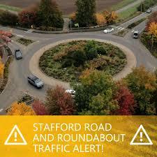
Stafford Hamlet resident, Rick Cook, wrote a song about traffic congestion on Stafford Road
Stafford Hamlet Resident, Rick Cook, wrote a song about traffic congestion on Stafford Road. https://www.westlinntidings.com/traffic-song/audio_a7ca0edd-6ce9-46cb-af71-2784ab0ebd38.html ...more
New
April 03, 2025•3 min read


Stafford Hamlet Board/CPO Monthly Meetings
2025 Events Calendar
Monthly Meetings are on the 2nd Tuesday of every month- with the exception of July and August.
There are no meetings in July and August.
Tuesday, April 8th
Tuesday, May 13th
Tuesday, June 10th
Tuesday, September 9th
Tuesday, October 14th
Tuesday, November 11th
Tuesday, December 9th
Click on the bottom below for the zoom link

